Madawaska River Guide
PADDLING THE MADAWASKA RIVER AND IT'S TREASURES... AN ARTIST'S PERSPECTIVE

Taylor Farquhar is an artist and whitewater canoeist based out of Palmer Rapids. After moving to the valley in 2018, Taylor drew her inspiration from the Madawaska River and those who paddle it in her watercolour paintings and pyrography. Since then, she has taken to bringing to life the many beautiful nooks and crannies of the valley for people who know it, who have felt it and those who have yet to experience it.
The Madawaska River is 230 km long and starts in Algonquin Provincial Park at Source Lake. It winds its way down to connect with the Ottawa River in Arnprior as one of the many rivers that make up the Ottawa River watershed. Its name comes from an Algonquian band of the region and like many rivers of this area it has a rich history of being cared for by the idigenous peoples before becoming a major river for logging and settler villages.
As friends of the Madawaska River it is important to know the history of where we have come from and do our best to leave as small of a footprint as we can on this waterway we cherish. For more information on the rich history of the Ottawa Valley, Madawaska River, Algonquins of Ontario and Log Drives you can click on the links at the bottom of this article.
The Madawaska River is known for being one of the best places for people of all ages and levels of experience to come and dive into the sport of whitewater paddling. Whether you’re new to paddling, want to improve your skills, camp out for some park and play or to do a multi-day river trip, there is a section of river here for you. When you come into town and say you want to paddle the Madawaska River you might get some questioning looks followed by “Which part?” It is important to know that the whitewater portions of the Madawaska River are divided into 4 distinct sections. The Upper Madawaska River Provincial Park, Middle Madawaska, Palmer Rapids and The Lower Madawaska Provincial Park.
THE UPPER MADAWASKA

This section of river flows through the Upper Madawaska River Provincial Park. It is located between the towns of Whitney and Madawaska and is a non-operational park that is 27km long. This means there are no facilities, no park fees and no one to clean it up but you! It is frequented by paddlers in high water seasons from April to June due to its exhilarating and continuous class 2-3 whitewater with a couple class 4-5 rapids peppered in to keep things nice and spicy ending in back to back unrunnable and dangerous waterfalls.
The Upper Madawaska River is for folks who are solid class 4 paddlers and able to run their own 22km shuttle. There are 2 main shuttle options. You can run the simple and easy shuttle from Whitney to the town of Madawaska. This would set you up to run this entire section of river including the rapids in Whitney and a longer lake paddle before again continuing down the continuous section of whitewater (leave yourself a solid 5+ hours to complete this entire section of river). There is public parking beside the dam in Whitney and it’s an easy walk down to the river below the dam to start your paddle. The take out is at a bridge on Major Lake Road which crosses the Madawaska river. Park on the side of the road.
Alternatively, you could do the far more challenging and 4WD mandatory shuttle along the hydro line (accessed off of highway 60) and railway bed to skip the first section and put in just past the lake for the shorter run (1-2 hours) consisting of only continuous whitewater. Once you get down to the rail bed, it runs almost the entire length of the river allowing you to choose the length of run you want. The rail bed allows for easy portaging and scouting of major rapids. Contact local paddling companies and river guide books for further information.
THE MIDDLE MADAWASKA

This is a 5 km stretch of whitewater between Bark Lake dam and Kamaniskeg Lake. The rapids are stacked for back to back fun ranging from class 2-4 depending on water levels. Throughout the week you will pass by fellow paddlers taking courses from Madawaska Kanu Center on the Middle Madawaska, challenging their skills on the slalom course and floating with friends. Depending on the amount of water in the Bark Lake reservoir, this section of river may only have releases from Monday-Thursday during the day rendering it unrunnable for whitewater paddlers outside of these times. The Bark Lake Dam and water release levels can be found by calling Madawaska Kanu Centre. To access this river you can put-in just below the dam, however, the easier and more popular access point is below the old railway bridge located beside the Siberia Rd bridge. The third access point is located at the footsteps of the Madawaska Kanu Centre. Park on River Road right beside the rapids where you can walk your boat down to the water's edge following the beautiful portage trails. After making your way down the river you will take out at the north end of Mud Bay. Parking is located on the side of River Road as the parking lot is private. Shuttle is easy to run and if you must walk it is only a couple of kilometres down the road to MKC. If you are looking to learn whitewater, advance your skills, get your certifications or go on family raft trips then you have come to the right spot. MKC (Madawaska Kanu Centre) provides a great experience for those looking to take courses. They offer 2-5 day whitewater canoe, kayak and rescue courses as well as some specialty and custom courses. Their programs have tasty meal options served at their rustic chalet and camping or lodging options on site. You can also just stop in for some coffee at their gift shop and say hi on your way to or from the river.
PALMER RAPIDS

Moving down river you come to Palmer Rapids which is just upstream of the town of Palmer Rapids. You can access the river from Pine Point on crown land, from Jessup’s campground if you are staying there or you can park at the Paddler Co-op and paddle up to the rapids. Pine Point is accessed off of a small dirt road located off of Dam Road and is accessible to everyone, everyday, but there are no overnight stays. Don’t fear the deeply rutted dirt road as you vear left down the beaten path to an open parking spot amongst pines on a point (hence the creative name). This was the original settlement of Palmer Rapids back in the logging days. Now it is a paddler park and play paradise and nature lovers walking area. There are two sets of rapids here that range from class 2-3 depending on water levels which make it a great place to learn and harness your skills. To find the updated water level click here for the Dam Release Gauge. You can easily do laps on laps, portaging back up to play on the upper and lower set. The Upper Set has three different rapids in higher water and only one in lower water called Jessup’s Chute, named after the campground it is located beside. If the chute is above your expertise, fear not the bottom outflow is the perfect place to warm up and learn before heading down the lower set. The Lower Set is a longer rapid filled with multiple lines to take and eddys to practice your skills. Jessup’s Campground and The Paddler Co-op are two great places located on the river to stay for your paddling visit. Both are classic campgrounds and open to everyone, paddler or not. Similar to MKC, the Paddler Co-op offers beginner to advanced lessons. They also offer various kids camps and youth paddling trips. Pack rafting? Private courses? The Paddle Co-op is capable of adapting to the needs of any group (or individual). Check out their website for more information. If you are lucky you can snag a ticket to Palmer River Fest, a local weekend paddling festival hosted on both the May long weekend and in September!

Canoeing Jessup's Chute -Taylor Farquhar

The Lower Set -Taylor Farquhar
LOWER MADAWASKA RIVER PROVINCIAL PARK
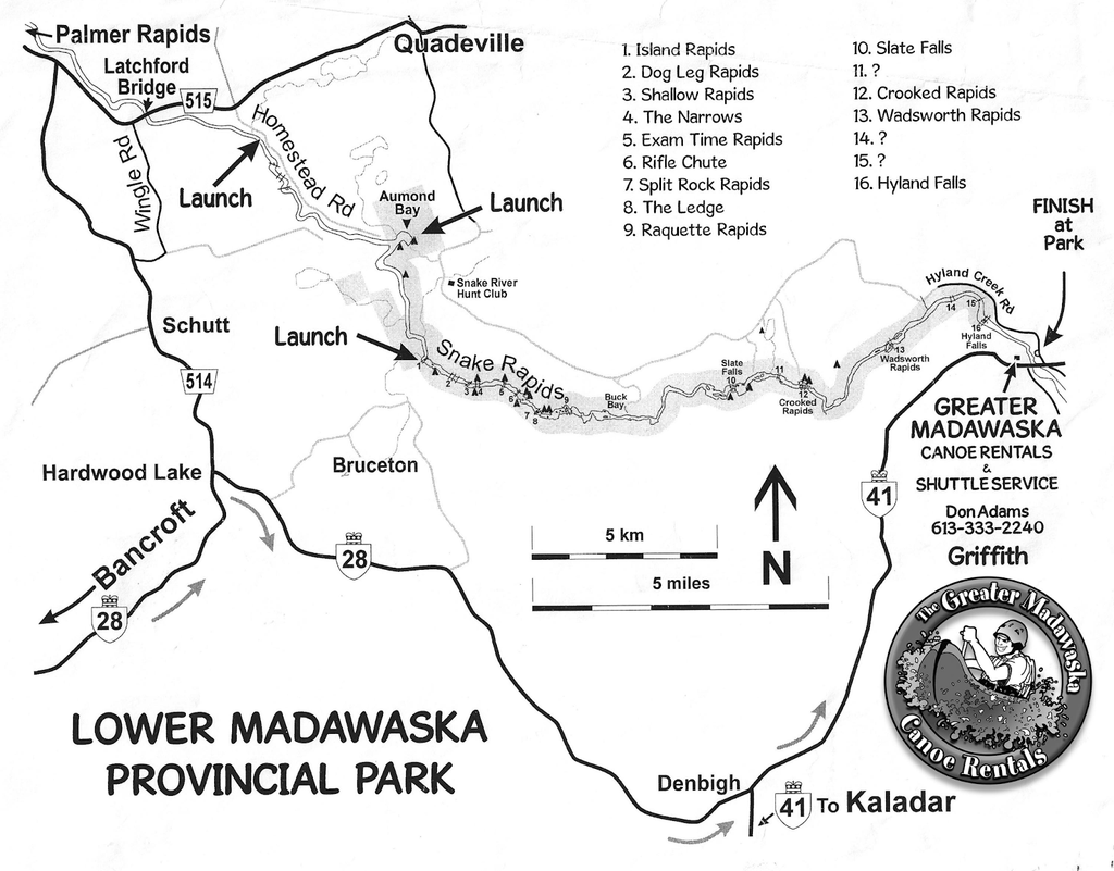
Map Links:
Detailed map from Palmer Rapids to Griffith
Detailed map for Aumonds Bay to Buck Bay
Finally, we made it down the river to the Lower Madawaska River Provincial Park. This section of river can be completed in a day, or you can take advantage of the free campsites and lap some rapids, play in the river and paddle the entire section down to Griffith in a few days. As it is another non-operational park, don't expect to find anything more than a parking lot and basic campsites. You cannot book the campsites in advance, and are instead first come, first served. This also means no one cleans the sites except the locals so please, please, please keep them clean and pristine (Thank you to the The Boundless School and passionate paddlers who keep our campsites clean and poopers clear). You can access this river by heading down Addington Rd in Quadeville, then continuing down logging roads until you have reached the sign for Aumonds Bay. Here you will set off on a 40 minute flat water paddle then hit rapids in drop pool succession all the way down to Buck Bay, takeout option #1 (locally known as bug bay, be prepared). If you are looking for a longer journey with both more rapids and more flat water, then you can continue down river to Crooked Rapids, take out option #2. On this leg of the journey you will portage around the beautiful Slate Falls and if you look hard enough you can find the carved gravestones of those who died here during the times of the log drive. After State Falls, you’ll navigate through twists and turns of class 1-2 rapids before reaching your takeout or campsite at Crooked Rapids. Finally, if you are keen to keep going with swift water and one smaller waterfall, then head on down to takeout #3, the town of Griffith. The take out is at the park on the left before the bridge. There is no overnight parking allowed here so make sure to arrange a shuttle or rentals of any paddling equipment with some of the local shops like Madawaska River Rentals, Paddler Co-op, Greater Madawaska Canoe Rentals and Madawaska Kanu Centre.
See you on the river!
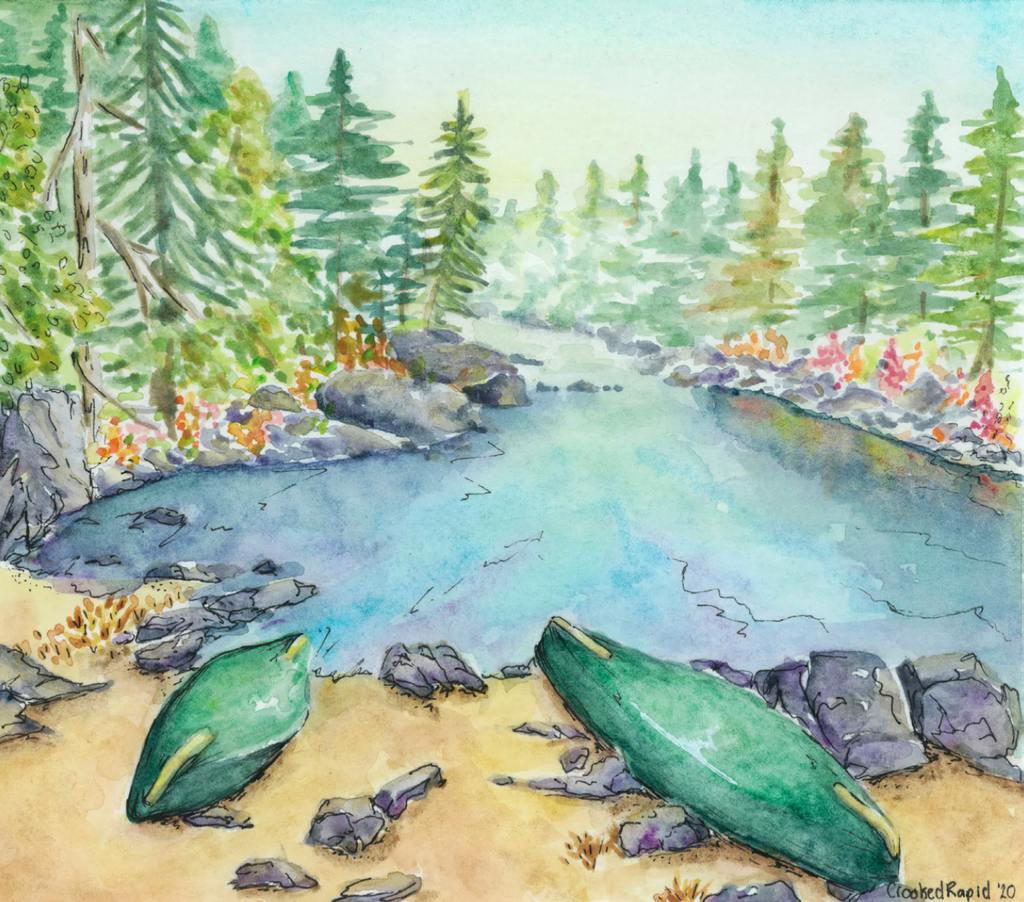
Crooked Rapid's Campsite -Taylor Farquhar

Buck Bay Sunset -Taylor Farquhar

Aumonds Bay -Taylor Farquhar

Island Rapids -Taylor Farquhar

Riffle Right Island -Taylor Farquhar
Resources:
Madawaska River Resources
http://www.cartespleinair.org/Canot/cartes.html
http://www.ottawavalley.travel/docs/paddleroutes.pdf
Historical Resources:
https://www.tanakiwin.com/algonquins-of-ontario/our-proud-history/
https://www.greatermadawaska.com/en/play-and-discover/the-madawaska-river.aspx
https://ottawariver.org/pdf/05-ch2-3.pdf